Students
taking the Earth Science Programme must enroll in the Field Skills 172, 272 and 374 modules.
The Field Skills 172 (1st year) module is composed of eight days field work spread over
the course of one year on weekends or holidays. These 1st year field trips
will cover the following aspects of geological field skills:
Defining lithological packages, recognizing map scale; working
with topographic maps and aerial photos whilst in the field
to record information and to locate yourself; identification
of sedimentary, metamorphic and igneous rocks and structures
in the field and their depositional or emplacement significance,
practical consideration of the natural environment.
The Field Skills 272 (2nd year) module is composed of 8 days compulsory field work spread
over one year. Field work will cover the following aspects
of geological field skills: Defining lithological packages,
recognizing map scale; use of structural compasses to record
structural information and geological map construction; working
with topographic maps and aerial photos whilst in the field
to record information and to locate yourself; identification
of sedimentary, metamorphic and igneous rocks and structures
in the field and their depositional or emplacement significance;
ore deposit indicators and rock associations; practical consideration
of environmental systems to understand the consequences of
mining activities.
The Field Skills 374 (3rd year) module is composed of 16 days compulsory field work spread over one year. These field trips will cover the following aspects of geological field skills: Defining lithological packages, recognizing map scale; use of structural compasses to record structural information and geological map construction; working with topographic maps and aerial photos whilst in the field to record information and to locate yourself; identification of sedimentary, metamorphic and igneous rocks and structures in the field and their depositional or emplacement significance; ore deposit indicators and rock associations; practical consideration of environmental systems to understand the consequences of mining activities.
1st year field trips (coordinator Dr. René Heyn):
Table Mountain
This field trip visits the famous landmark Seapoint contact
followed by a walk up Lions Head. The aim of the visit is to overview the
sedimentology of Table Mountain and contact relationships with the Malmesbury
Group floor rocks and Peninsula granite. You will be introduced to
stratigraphy, sedimentary features, geological contacts, structure, and erosion.
Bloubergstrand
This field trip will
look at rocks exposed along the coast line at Bloubergstrand as well as some of
the geomorphological processes that have shaped the coast at this point. Here
the rocks are mostly Malmesbury Group shales but in contrast to the rocks
closer to Cape Town are more highly deformed. Other rock types include unusual "lavas"
that form a small island joined to the mainland by a tombolo at small bay.
Catchment to Coast
During this field
trip, we will visit an estuary in Western Cape and learn about surface and
sub-surface estuarine processes. Estuaries are important ecological systems and
are a major contributor to global carbon budget. They are a transitional system
between fresh water and marine waters resulting in highly bio-diverse
environments.
False Bay Granites
This field trip will
investigate the mineralogy and textures of granites of the Cape Granite Suite
exposed in coastal outcrops along False Bay. Particular attention will be paid
to gradational and cross-cutting relationships between different igneous rock
types. We will also examine the different types of igneous and metamorphic rock
fragments (enclaves) carried by these granites to determine what they tell us
about the geological evolution of the Western Cape.
Hartebeskraal Hydrogeology
Hartebeskraal Farm
sits on the edge of the Klein Drakenstein Mountains. These mountains are made
up of rocks of the Table Mountain Group (TMG) which, when fractured, make very
good aquifers. Hartebeskraal Farm runs a water bottling plant that abstracts
water from a contact spring between the Malmesbury Group Shales and the base of
the Table Mountain Group in this area. Springs like this occur all along the
base of this mountain range between Paarl and Franschhoek and host a number of
water bottling plants. This field trip will provide a general overview of the
TMG aquifer project and discuss issues surrounding the bottled water industry.
We will begin by having a look at the water bottling plant, then walk up the
mountain to look at the geology and the source of the springs.
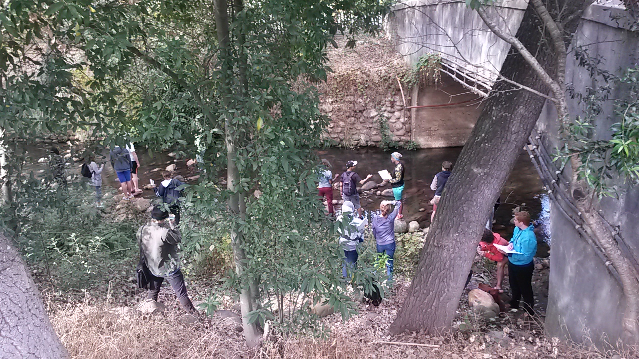
Ponds, streams and the ocean
This field trip
first visits ponds in Stellenbosch to learn about biogeochemical processes in
well-defined small aquatic systems, and understand the concepts of in- and
outflow and residence time. These are important concepts for water quality. We
will then walk to the Stellenbosch River to learn more about water sources and
discharge patterns in an urban stream. The second half of the field trip will
be spent at the sea as an example of a large, open system.
Introduction to
field work
The Clarence Drive
between Gordon’s Bay and Kleinmond exposes rocks that formed some 700-450
million years ago. Since then, the rocks have been affected by a number of
later events, which also determine the nature of the present-day coastline.
This trip examines a number of key outcrops that illustrate some fundamental
processes in geology, such as sedimentation, uplift and erosion, folding and
faulting. You are expected to describe and document the main features that we
visit during the day, providing a summary of the main geological events that
have shaped this part of the coastline.
2nd year field trips (coordinator Dr. Jodie Miller):
Rooiels
We visit the Rooi Els estuary to analyse parameters controlling
water composition and quality.
![]()
Laingsburg
see the 2015 tour  here
here
